Biography
I am a Research Scientist at the University of Delaware. My research interests include mapping aquatic habitats, acoustics, hydrology, and open-source software and tool development.
Interests
- Acoustic Remote Sensing
- Algorithm Development
- Big-Data Wrangling
- Software & Tool Development
- Machine & Deep Learning
- Hydrologic Data Modeling & Analysis
Education
PhD in Ecological Informatics, 2024
Northern Arizona University
Graduate Certificate, GIS, 2015
North Carolina State University
Bachelor of Landscape Architecture & Environmental Planning, 2011
Utah State University
Experience
Research Scientist
- CSHEL - Coastal Sediments Hydrodynamics and Engineering Laboratory
Postdoctoral Researcher
- CSHEL - Coastal Sediments Hydrodynamics and Engineering Laboratory
Graduate Research Assistant
- Develop open-source software (PINGMapper) and reproducible workflows for processing big datasets from recreation-grade sonar instruments.
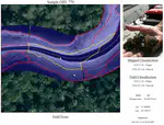
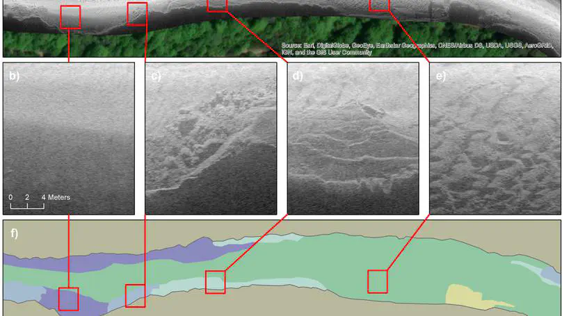
- Train and evaluate deep learning models for substrate segmentation and classification from sonar imagery.
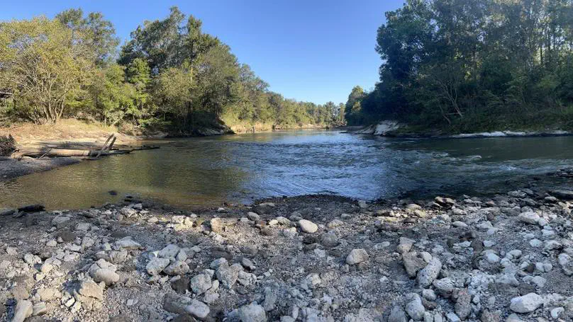
- Identify suitable spawning reaches for the threatened Gulf Sturgeon in the Pearl and Pascagoula systems in Mississippi, USA.
- Author peer-reviewed manuscripts and present at national and regional conferences.
- Coordinate field campaigns with research partners.
- Provide bug patches and enhanced functionality based on end-users input.
Biological Scientist II
- Interpret fine-scale side-scan sonar imagery and classify river substrates.
- Plan and conduct riverine field campaigns involving operation of recreation-grade side-scan sonar, GPS, motorized/non-motorized vessels, and trailering.
- Design and maintain ArcGIS REST Services and maps for distribution of river substrate data.
- Develop Python scripts for batch processing, data management, and computations.
- Serve as agency point of contact for riverine side-scan sonar inquiries and requests.
- Prepare technical documents and present research at agency, regional, and national meetings.
- Formulate FWC boating policy as Watercraft Safety Advisory Board (WSAB) advisor.
Research Associate
- Provide technical assistance on Cooperative Land Cover project.
- Develop custom Python workflows for batch processing and management of big datasets.
- Utilize ArcGIS 10.x to classify medium resolution imagery to edit and update landcover datasets.
- Enforce vector topology and domains for quality assurance.
Teaching Assistant
- Courses: Geographic Information Systems I & II (Graduate Level).
- Co-develop course lectures with instructor for ESL students.
- Lead skill-based lab for students with varying technical experience.
- Respond to student questions and provide one-on-one tutoring.
Featured Projects
Open-source software package for reading, processing, and mapping side-scan sonar data.
![Impacts of snow cover and extent on timing of wildfires [Research Proposal]](/project/team-based-research/featured_hu82651ad1d79881a0a6ec557d301467e5_203896_b8d7ddc78ef00c5576e54ed9611f9b27.webp)
Featured Publications
Recent Publications
(2023).
PING-Mapper (v2.0.0) [Software].
Zenodo.
(2023).
Sidescan Sonar Substrate, Depth, and Shadow Models for PINGMapper v2.0.0 (v1.0.2) [Model].
Zenodo.
(2022).
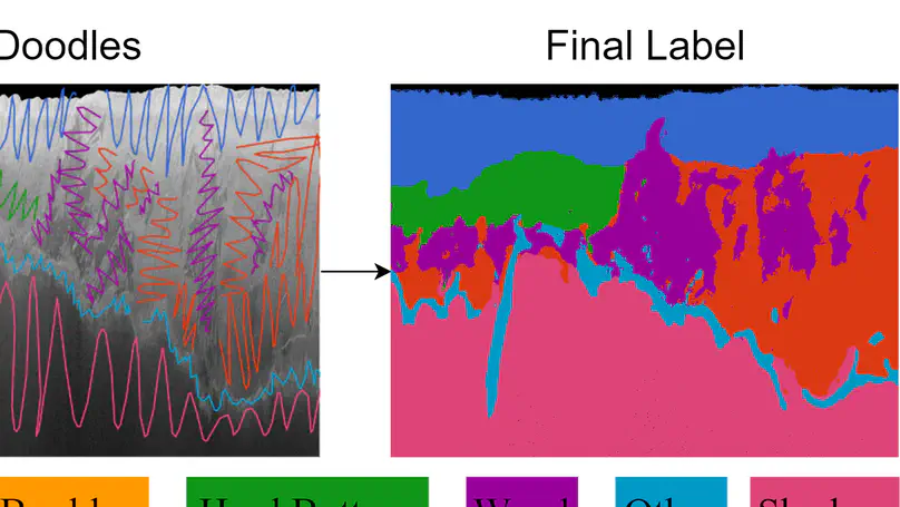
Human‐in‐the‐Loop Segmentation of Earth Surface Imagery.
Earth and Space Science.
(2022).
PING-Mapper (v1.0.0) [Software].
Zenodo.
Recent Talks & Posters
(2024).
Efficient and Reproducible Substrate Mapping with Recreation-grade Sonar Systems [Poster Session].
Popular Topics
Contact
Feel free to reach out to discuss collaboration opportunities or with any questions.
- bodine.cs@gmail.com
- Flagstaff, AZ 86004